

Gateway Guides: Why Paper Maps Are Making a Comeback in Cape Town
Loading player...
Featuring Clifford Smith, Gateway Guides
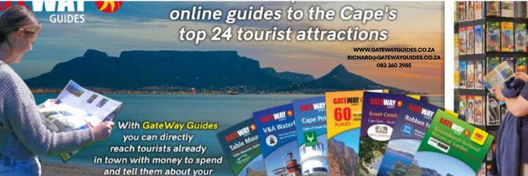
On this episode of The Real South African, Geniene sits down with Clifford Smith from Gateway Guides — not a tour guide, but a printed guide. Gateway Guides produces over 20 large-format (A2), full-colour tourist guides covering everything from Table Mountain and Robben Island to the V&A Waterfront, Kirstenbosch, the Cape Winelands, the Garden Route, and beyond. Everything printed is mirrored online at gatewayguides.co.za.
The guides work as a two-sided platform: tourists get free, richly detailed information (with only about 20% of each page given to advertising), while small and medium tourism businesses get an affordable way to get in front of visitors who are already reaching for their wallets. One standout product is the Cape Town street map — a detailed, double-sided paper map of the City Bowl, Atlantic Seaboard, and Cape Peninsula that's proven surprisingly popular in an age of GPS navigation.
Clifford and Geniene talk about why paper still has an edge: better route awareness while driving, no dead batteries or lost signal on hikes (their Table Mountain guide includes step-by-step directions through Platteklip Gorge, where phone signal often drops out), and the fact that visitors keep these guides as holiday keepsakes long after they've left South Africa.
Gateway Guides has been running for almost a decade, has printed more than 4 million guides, and is available free at around 70 distribution points — including the Table Mountain cableway, the Cape Town Visitor Centre, and Cape Town, Johannesburg, and Durban airports. New regional guides (Johannesburg, KwaZulu-Natal, Northern Cape) are on the table if local advertiser interest lines up.
Find them: gatewayguides.co.za
On this episode of The Real South African, Geniene sits down with Clifford Smith from Gateway Guides — not a tour guide, but a printed guide. Gateway Guides produces over 20 large-format (A2), full-colour tourist guides covering everything from Table Mountain and Robben Island to the V&A Waterfront, Kirstenbosch, the Cape Winelands, the Garden Route, and beyond. Everything printed is mirrored online at gatewayguides.co.za.
The guides work as a two-sided platform: tourists get free, richly detailed information (with only about 20% of each page given to advertising), while small and medium tourism businesses get an affordable way to get in front of visitors who are already reaching for their wallets. One standout product is the Cape Town street map — a detailed, double-sided paper map of the City Bowl, Atlantic Seaboard, and Cape Peninsula that's proven surprisingly popular in an age of GPS navigation.
Clifford and Geniene talk about why paper still has an edge: better route awareness while driving, no dead batteries or lost signal on hikes (their Table Mountain guide includes step-by-step directions through Platteklip Gorge, where phone signal often drops out), and the fact that visitors keep these guides as holiday keepsakes long after they've left South Africa.
Gateway Guides has been running for almost a decade, has printed more than 4 million guides, and is available free at around 70 distribution points — including the Table Mountain cableway, the Cape Town Visitor Centre, and Cape Town, Johannesburg, and Durban airports. New regional guides (Johannesburg, KwaZulu-Natal, Northern Cape) are on the table if local advertiser interest lines up.
Find them: gatewayguides.co.za


